Hi rnvinc
I have a problem on 360 imaging as well as side scan, as they both
work the same. I have not been able to resolve it and I thought I
would ask for your opinion as you are well versed in side imaging.
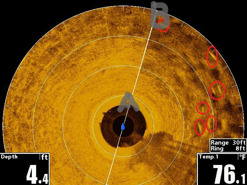
I'm including a scan for an example.
Let's assume that the boat is pinned with two power poles so it
is fixed and cannot move. The bottom is level.
Question 1 -- Would the spot marked A in this scan image be directly
under the side scan transducer ?
Question 2 -- The range on this screen shot is set to 30 feet. The depth is 4.4 feet.
Is the distance from a point on the bottom directly under the transducer (A) to a point on the bottom
at the extreme edge of the scan (B) 25.6 feet ?
thanks kindly, Chris


 Likes:
  Thanks:
  HaHa:
HaHa: 




Originally Posted by doctorxring


 Reply With Quote















