 Thanks:
  HaHa:
HaHa: 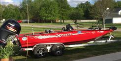

 Reply With Quote
Man im loving these images!!!!!!!

 Trophy King II

When I started out mapping, I added a couple of waypoints as I was mapping. I want to see if I can add the SI pics to the map and have them pull up the pic when I select the waypoint on the map in my autochart pro. Here are the SI images of the first three waypoints. The first two I took real close together. If you notice in the lower right corner of these two you can see the fish beds. I didn't think to zoom at the time, will have to play with that next time.
Crappie.com 3K Star General
Man im loving these images!!!!!!!
Trophy King II
something I noticed, but forgot to mention about the pictures that I find odd, if you look at the first two pictures in the SI image, you can see the interference from the outboard at idle speeds. In the third picture, I sped up to about 5 miles per hour and the interference went away, you can actually see it fade out on the third pic.
Xpress H20PFC with 150 Vmax SHO
Ulterra I-pilot Link networked with Helix 10 SI Bow and Dash
SpyderLock's on the front and Tite-Lok's on the back
Creekslick Rod Holders and Millennium seats for Summer
Crappie.com 1K Star General
gz when you upped your speed you pushed the boat / ducer forward of the turbulance made from the prop. Turbulance is what you see to the left of center. No blocking of beam left tells me the motor is out of the way just slow boat speed with prop wash going on...raising it a bit more would hurt.
Those are some Great shots bud!
IceNitro LIKED above post


