Not yet Don, I've only had it out one time. Some of us have to workOriginally Posted by Don G

.

 Likes: 0
 Thanks: 0
 HaHa: 0
 Crappie.com 2K Star General

Not yet Don, I've only had it out one time. Some of us have to work
Crappie.com Legend
Justin, you can't miss work; we need your SS contribution.
If you only get out occasionally, then you just need a smaller unit. Send me your 12 and I will send you my 7......
USS Intrepid CVS-11 Helicopter Squadron-3 1960-1964
When I keep my gratitude higher than my expectations I have a good day
Crappie.com 2K Star General
Don sent me the picture, and I brought it to his attention. On the DI side, the digital depth reading is 36.5 feet. Looking at the bottom on the sonar image, the bottom drops off from about 25 feet to 30 feet. About a 6 foot discrepancy. here's another screen shot Don sent me. On this one, the bottom depth looks to accurate at the point the picture goes off the screen, which is as it should be.
Super Moderator
Don I like the Amber best too. I thought it strange that the Blue on this 1198 is not the same Blue that I had on my 1197. I like the Blue a lot on my 1197, but not on this 1198. Kind of strange I think that they changed it and to a Blue that is to me not as good.
Peak Vise Dealer
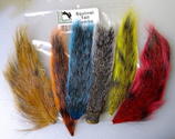
Tying Materials, Chenille and Hackle
For Pictures of my Crystal, Nylon/Rayon or
New Age Chenille Please PM Me! Also I
have the Saltwater Neck Hackle and some
colors of Marabou plus other things!
Crappie.com 2016 Man of the Year
* Member Sponsor
Ok so my initial impression is moot because I did not even look at the digital depth readout of 36.5...
I agree with others here that the digital depth is derived from the 2d cone shaped beam which would probably be processing the bottom return differently than if the digital depth was derived from the SI crystals...
I have read interesting discussion about the "dead zone" in a 2d sonar cone....but I don't see how that "dead zone" discussion could apply here unless somehow the Lowrance is getting digital depth from the "frontal reaches" of the cone (which would be in front of the SI beams somewhat)...but, like I said...I don't think Lowrance derives digital depth from the front part of the cone.....I think all sonar companies process the "strongest" reoccurring return in the 2d cone as the bottom..
So I'm gonna say in your image scenario...I don't know why the digital depth is showing 6.5ft deeper than the scales overlayed in the DI and SI I ahead...
Rickie
Last edited by rnvinc; 08-27-2013 at 02:52 PM.
www.podunkideas.com <--Click here
------------
https://www.crappie-gills-n-more.com/
https://cornfieldfishinggear.com/
------------------------>> Pro Staff Sonar Advisor
Crappie.com Legend
I say the 36.5' is the depth AT the moment you took the snapshot, not the depth of the tree, it looks like the depth at the base of the tree is about 30' to me, but I'm no expert with these things. The digital depth in the upper left updates with every ping, while the picture scrolls across the screen would a bit of "history" since you have already gone over or past it by the tree is in the center of the screen. I have a G1 LOL.
GO BIG ORANGE !
I meant to behave, but there were just way too many other options available at the time.
Crappie.com 2K Star General
The picture being "history", and the actual depth at the time of the snapshot makes sense. So looking at the first picture, off the screen to the right, the sonar is reading a 36 foot depth? But if you consider the second picture with the 18 foot depth reading at the edge of the picture being "history" you would think with the way the bottom is dropping off, the digital depth would be much greater than 18.6 at the time of the snapshot. SOG was very close for the 2 images.
Don, I think a gremlin jumped out of Gene's unit and took up residence in your new Touch 7.
Crappie.com 2016 Man of the Year
* Member Sponsor
I think this gremlin would be a good one for Jason Gilstrap...
Rickie
www.podunkideas.com <--Click here
------------
https://www.crappie-gills-n-more.com/
https://cornfieldfishinggear.com/
------------------------>> Pro Staff Sonar Advisor
Posting Permissions


 The brown is the closest I can find. Do you have any snapshots using your 12 Touch? I have used Auto & manual settings trying to get the best snapshots that I can.
 Reply With Quote