
Likes:
0

Thanks:
0

HaHa:
0
-

Here's another website that you may want to keep watch on if/when you decide to come down this way & fish our lakes : Louisville District Daily Lake Report
You need only to click on the "Today's Pool Feet" number (highlighted) across from the particular lake, and you'll be taken to a chart showing the water levels over the previous year. Like this one from Cave Run :
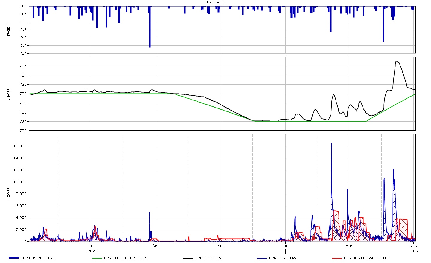
And as you can see .... had your trip been "pre-planned" for the April/May time frame, then May would have been your best shot at any decent water conditions, as the whole month of April was plagued with fast falling water levels. Taylorsville Lake was in a similar situation during that time frame.
I also use this site as a reference to the COE site link above: Lake Levels in Kentucky, United States ... as it shows water levels more than once a day, and I can determine (by comparing the two) if the lake is rising or falling in relation to the COE chart levels (which are usually updated in the early AM and only that one time, that day).
Tags for this Thread
 Posting Permissions
- You may not post new threads
- You may not post replies
- You may not post attachments
- You may not edit your posts
-
Forum Rules
BACK TO TOP


 Reply With Quote


