Gooch .... you can keep track of water levels at this site :
Louisville District Daily Lake Report
Click on the blue numbers under "Today's Pool Feet" (across from whichever lake you're interested in) and it will show you a chart of the past year's rain & water levels.
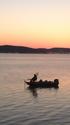
I was there on Friday (830A-130P) around the Lone Valley area. Casting jigs & jigging brushpiles in 15-20fow ... and the dinks were hammerin

Water's surface temp was around 72* (only checked it once) ... water color was normal
Bite was strong early, but tapered off towards midday. I checked this site, on Thurs, and it was pretty accurate for the timeframe I was there :
Campbellsville Fishing Reports and Fishing Forecasts - weather.com
I was there mainly to do a shakedown cruise (checking boat/motor/GPS performance), since I haven't had the boat out in quite a while. And I had some GPS coords that I put into my depth finder, and wanted to see how accurate they were & whether or not I could even find them (since I'm still learning how to operate my Lowrance Elite 5DSI/chartplotter depthfinder).
I'm happy to say that my E5DSI was spot on, and it drew me some real purty pictures of the brush, trees, & pallets that I was looking for !!
... cp


 Likes:
  Thanks:
  HaHa:
HaHa: 


 Reply With Quote
Originally Posted by bkgooch


 .
. .. was you crankin them? Usually you are going home at that time (12-1).


