Reply With Quote
I do know the wind is whoopin my rear this afternoon

 Likes: 0
 Thanks: 0
 HaHa: 0
 Crappie.com 1K Star General

Strong wording from MS emergency management!
@TRex21: MEMA Dir. Robert Latham: Incoming system potentially "catastrophic."
Biggest crappie to date is 3 lb 9 oz at grenada in 1988. Still hangs on my wall.
Crappie.com Legend
I do know the wind is whoopin my rear this afternoon
1990 Stratos 285 Pro 200 HP Merc
SpyderLok Rod Holders
Proud Member of Team Watch The Finger!!!
(662) 458-8925
Crappie.com 3K Star General
major flooding between mempho and sardis. and they say it may very well get worst before it is over. turn around, don't drown!!

DEAD AS FRIED CHICKEN
Crappie.com 1K Star General
Secondary warm front continues to try to push northward across the
cwa. Ongoing convection is slowing the fronts progress. Over the
last hour...it seems to finally making some progress as convection
has lifted out of tunica and st francis counties. Skies are
starting to clear across portions of coahoma and tallahatchie
counties. A warm and juicy atmosphere exists just south of these
counties where temperatures have risen into the lower to mid 80s.
Dewpoints are in the upper 60s to lower 70s. This airmass will
spread into the midsouth this evening. A strong upper level jet
may interact with this airmass to produce a few supercells this
evening. However...better chances for storms will come later this
evening as storms develop ahead of the dry line...which is roughly
located near the ok/ar border at this time. These storms will
push east across arkansas this evening producing damaging
winds...large hail and possibly a few strong...long tracked tornadoes.
Biggest crappie to date is 3 lb 9 oz at grenada in 1988. Still hangs on my wall.
Crappie.com Legend
Time for me to get off the lake, just got a tornado watch alert on my phone.

1990 Stratos 285 Pro 200 HP Merc
SpyderLok Rod Holders
Proud Member of Team Watch The Finger!!!
(662) 458-8925
Crappie Wall Hanger II
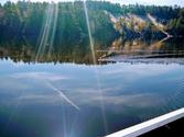
Rees, what is that pic of ?
Looks like a calve with shaving cream.
Crappie.com 3K Star General
I see fish and somethin on top of the water.
Crappie.com Legend
Just a glare, wonder if my flash went off, anyway here's a better one. Wind was tuff, had to pull a drift soft when going with the wind to keep the boat straight at 1 mph.

1990 Stratos 285 Pro 200 HP Merc
SpyderLok Rod Holders
Proud Member of Team Watch The Finger!!!
(662) 458-8925
Crappie.com Legend
Hope the weather passes over all of us. Nice fish by he way.
FISH ON
Crappie.com 3K Star General
Nice fish John. Glad you got back in safe.
Proud Member Of Team Geezer
Member: Michigan Chapter of Team Overalls
Posting Permissions