Likes:
  Thanks:
  HaHa:
HaHa: 


 Reply With Quote
I'm not sure exacly what you're asking but I hope this helps. You don't say what kind of GPS you are using.
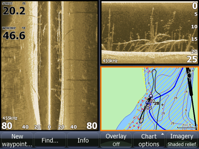
Once you save a way point, it will show back up on a map (chart) See below 2 spots are marked #2 & #3. I marked each end of the tree. No need to name the waypoints if you don't want to.
However if you are marking spots with a handheld unit (such as an e-trex) you wouldn't have a map to reference to.
I have waypoints marked in both types of units. For the hand held, I just use the next available number to mark a waypoint but I do keep a small note book or log book with my waypoints sorted and some notes about each spot if needed. e.g. #37- brush pile on point 12 fow or #13- stump field on flat 13 fow
Most units do have the abilitly to store data (names) if thats what you really want to do..